

Ceapabhal [Chaipaval]
Good walks are even better shared.
Overview
Ceapabhal [Chaipaval]
Overview
Ceapabhal, majestically standing at 684 meters, is not only a Marilyn but also a joker in the hierarchy of mountains—small but mighty! Nestled in the Outer Hebrides, this peak offers hikers a fantastic blend of challenge and scenic enjoyment.
Geology
The terrain is predominantly made of ancient Lewisian gneiss, an interesting geological phenomenon that gives a glimpse into Earth's history. It’s the sort of rock that's been around since before the time of the dinosaurs. If rocks could talk, this one would have more stories than your grandad!
Routes
The standout route is the Ceapabhal Circular Route, which span approximately 8 km and takes around 3 hours to complete. It starts from the picturesque village of Scarista, winding through lovely moorlands and offers stunning coastal views as a bonus. Just be sure your legs are up for a bit of a stretch!
Summit Features
Reaching the summit is marked by a traditional stone cairn – perfect for that Instagram moment! Standing here, you might feel like the king or queen of the world, or at least the king or queen of the nearest café.
Terrain Type
The terrain varies, mixing rocky outcrops and verdant grassy patches with the occasional bog thrown in for good measure. Take your wellies if you fancy a proper adventure!
Views
Marvel at the breathtaking panoramas revealing the sprawling landscapes of Harris, with enchanting glimpses of the Atlantic Ocean. For the best views, aim to hike in late spring or early autumn when the skies are clearer and the heather is in bloom, painting the hills in purples and pinks.
Hazards
Prepare for sudden weather changes! The Scottish Highlands can throw a curveball that no one sees coming, so even in summer, packing an extra layer is a wise idea. And do watch your step; the bogs can be quite cheeky!
Nearby Summits
Consider adding Beinn Bhreac and Hecla to your list, both of which promise delightful cross-country trails and splendid views.
Access
The nearest parking can be found at Scarista Beach, about 4 km from the trail. There are limited public transport options, so bringing your trusty steed (vehicle) is advisable! Tarbert offers the closest town amenities, including a café that’s definitely worth a visit after your outdoor escapades.
Facilities
Facilities are sparse in these parts, but a lovely café exists in Tarbert to reward yourself post-hike. Scarista Beach also provides essential toilet facilities, so no need to worry about sudden nature calls!
History
The name Ceapabhal reflects its landscape features, translating to 'Hillside' in Gaelic. The mountain adds to the cultural tapestry of this area and serves as a splendid backdrop to the traditional island life.
Whether you're a seasoned hiker or just someone who enjoys a good walk with magnificent views, Ceapabhal will steal your heart!
Explore routes near Ceapabhal [Chaipaval]
Public walks starting within 80 km of this hill. Nearby does not mean a route reaches the summit; check its map and access before setting out.
Berneray Community Hall to the beautiful beach
View route
Beautiful private beach walk Isle of Harris
View route
Dun Mhulan Broch Quick Walk
View route
Route planning notes
These notes describe possible approaches, not verified navigable routes or permission to cross land. Check current paths, local access rules and conditions before setting out.
Ceapabhal Circular Route
A delightful circular route starting from the village of Scarista, taking you across scenic moorland, with views of the Atlantic Ocean.
Make a day of it, together
Find someone to share the walk with, or organise a day out along a route you like.
Photo Gallery
View all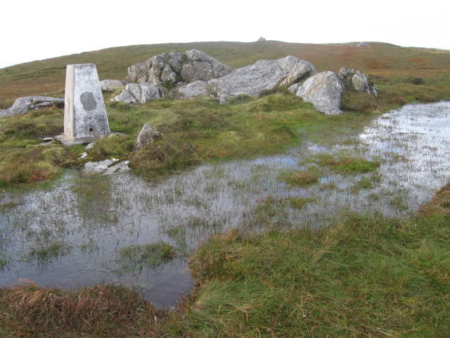 Photo could not load
NF9792 : Chaipaval trig point S8988
Chris Wimbush
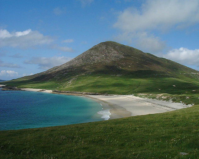 Photo could not load
NF9792 : Ceapabhal
Keith Wilson
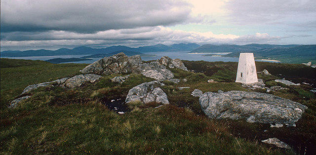 Photo could not load
NF9792 : The OS Trig station on Ceapabhal
Julian Paren
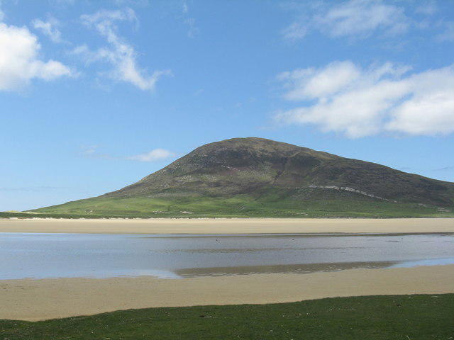 Photo could not load
NF9792 : Ceapabhal seen across Tràigh an Taoibh Thuath
M J Richardson
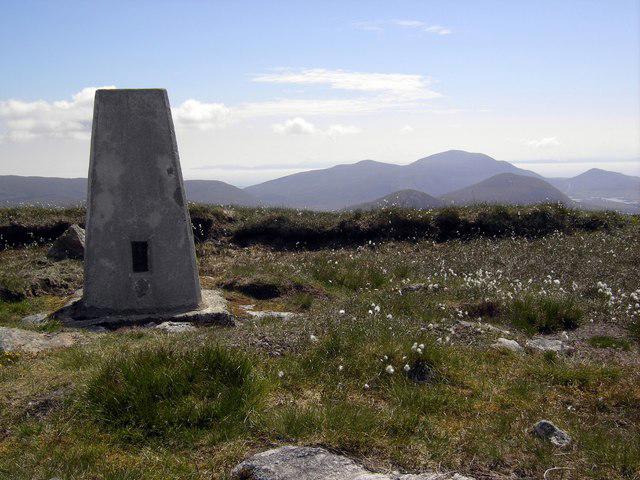 Photo could not load
NF9792 : Ceapabhal trig point
Colin Kinnear
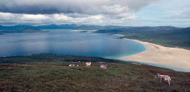 Photo could not load
NF9792 : North east from Ceapabhal summit
Julian Paren
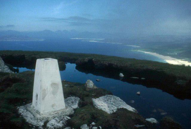 Photo could not load
NF9792 : Ceapabhal's trig pillar
Alan Reid
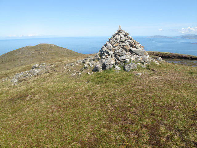 Photo could not load
NF9792 : Chaipaval [Ceapabhal]
Rude Health
Hill facts and local notes
Classifications
Elevation
368m
1,207 ft
Prominence
365m
Coordinates
57.8188, -7.1014
NF972924
OS Map
18
Explorer: 455
At the Summit
At the summit, you'll find a well-constructed stone cairn, which is a great spot for a photo as you bask in the glory of your accomplishment. Don't forget to give it a friendly pat!
Terrain & Geology
Ceapabhal is composed of Lewisian gneiss, a beautiful yet ancient rock type, estimated to be over 3 billion years old. This fascinating geology makes it one of the oldest terrains in Scotland.
Views & Scenery
From the summit, you'll be treated to stunning views of the surrounding islands, the rugged coastline, and on a clear day, the distant peaks of the mainland Highlands.
History & Heritage
Name Origin
The name 'Ceapabhal' translates to 'Hillside' or 'Hill of the Small Point' in Gaelic, reflecting its geographical features.
Historical Significance
Ceapabhal is significant for its stunning landscape and as part of the island's unique ecology. The area is home to various species of birds and wildlife.
Getting There & Facilities
Check current local access restrictions, parking rules and transport timetables before travelling. These notes do not confirm public access to the summit.
Parking
Parking is available at Scarista Beach, which is approximately 4 km from the trailhead. The beach is a popular spot and worth a visit even if you're not walking.
Public Transport
Public transport to Scarista is limited. However, there are regular bus services from Stornoway that can get you closer to the area.
Nearby Facilities
While facilities are sparse, you can find a lovely café in Tarbert for some much-deserved refreshment after your hike. Toilets are available at Scarista Beach.
Safety Information
Known Hazards
- Potential for sudden weather changes. The Scottish Highlands can be notoriously fickle, so pack an extra layer just in case. Watch out for bogs, especially after wet weather.
General Safety Tips
- Check weather conditions before setting out
- Carry appropriate clothing and equipment
- Let someone know your planned route
- Take a map, compass, and GPS device
- Carry emergency supplies: food, water, first aid kit, torch
Hills
Some common questions about the hills answered
Are there group walks up Ceapabhal [Chaipaval]?
Many walkers use Walkmates to join or organise walks with others. You can check for group walks around Ceapabhal [Chaipaval] through the maps
Are there other walkers around Ceapabhal [Chaipaval]?
Activity varies by location and time, but Walkmates lets you see whether others have shared walks or shown interest in this area. Find other people through the walking friends search walking friends for Ceapabhal [Chaipaval] search or of course create your own walk for Ceapabhal [Chaipaval]
Can I organise a walk to Ceapabhal [Chaipaval]?
Yes. If there aren’t any walks listed already, you can create a walk and make it available for others to join.
If you're signed up to Walkmates, you can create a walk to Ceapabhal [Chaipaval].
How do I find a walk up this hill?
There are often multiple ways to walk this hill, depending on experience and route preference. Walkmates helps you explore walks and routes that others have shared.
Can I suggest a new route up Ceapabhal [Chaipaval]?
Yes. You can suggest or create routes to share with others. Walkmates focuses on the social side of walking, so routes are used to help people organise walks and explore areas together, rather than as detailed navigation tools or route libraries.
Other uses really appreciate knowledgeable walkers sharing their routes. Share your favourite route to Ceapabhal [Chaipaval] here
The is an error or something incorrect about this hill. How do I let you know?
We always strive to keep the information on Walkmates as accurate as possible. If you find an error, please let us know through the contact form and we'll aim to correct it as quickly as possible
Community Discussion
Comments
Location
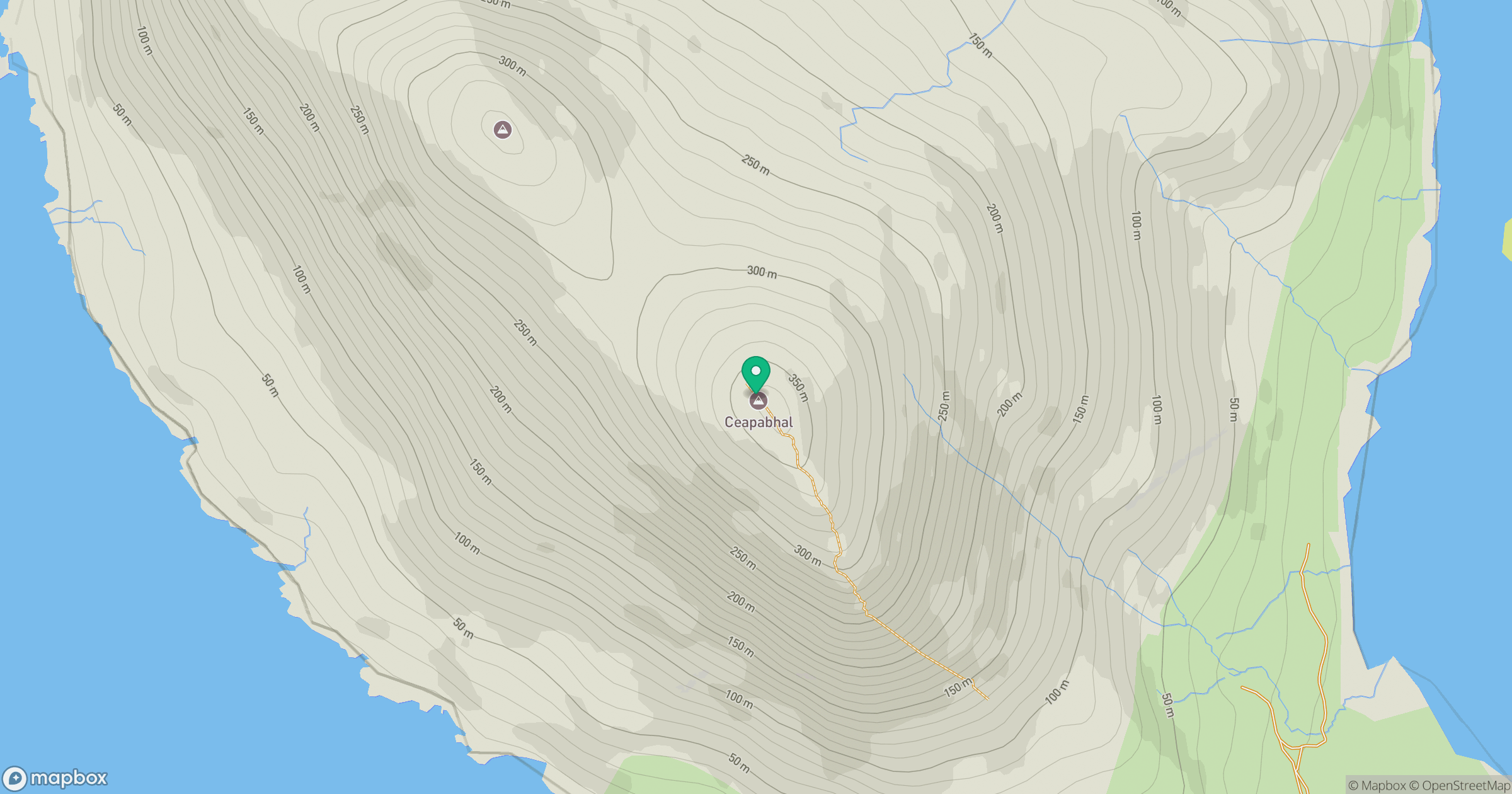
Grid reference: NF972924
View on OpenStreetMapOpens a map in a new tab, centred on the hill.
Hills within 30 km
Straight-line distance, not a walking route or confirmation of access.
An Cliseam [Clisham]
800m
Greabhal
280m
Bleabhal [Bleaval]
398m
Beinn a' Charnain
196m
Sranndabhal
211m
No comments yet. Be the first.